Chalet
Hill
Dunstable,
MA
c1939-?
History ~
By the Year
History
This small ski area
was located in Dunstable, but was advertised as being located in Tyngsboro in a
1939 guide. This was a very obscure area that only appeared that once, and never
again. It was a mystery for us for a long time, but
Bryan Leary
has found out some information on the area, and actually found the remnants!
Here are his details from a September, 2008 visit.
|
In discussing the Chalet Hill Ski area
with a few old timers at the Tyngsboro Sportsmen’s Club, I found out
that the ski area was not where you thought it might be - on Locust Hill
in Tyngsboro - but rather was on Nutting Hill which is actually in
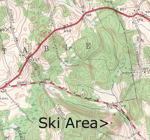
Dunstable. I have a 1950 topographical map (right) that shows a
structure on both the top and bottom of this 310 foot elevation hill in
a northeast line, but the hill is not identified. However, when using
Google Maps in this location, and zooming in under the Terrain tab, it
identifies the hill as Nutting Hill. I scanned this area of the map for
you and I have attached it.
You will notice that Nutting Hill is on
the west side of Dunstable Road just opposite the end of Cummings Road,
while the east side of Dunstable Road in this area is Tyngsboro. You
should also note on the map the Chalifoux farm – hence the name Chalet –
which is located on the west side of Dunstable Road approximately .33
miles south of Cummings Road. Some of the old timers remember the farm
and the hill which was a rope tow operation of course. Nutting Hill is
directly across the road from the infamous Charles George Landfill
Superfund Site.
|
 |
|
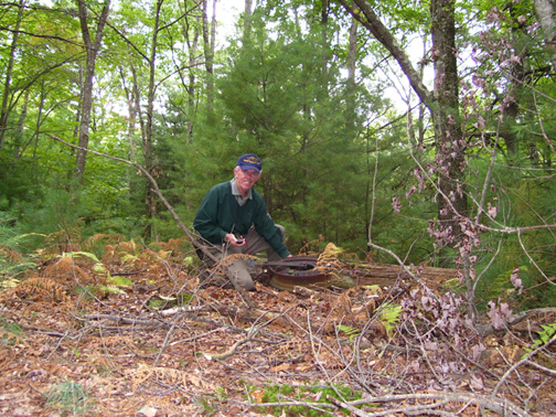
Bryan Leary next to a former lift tower. Click on the image for a closer
view. |
On September 22, 2008 I was on a mission
to find evidence of this rope tow operation. With my Silva compass,
GPS, and topo map in hand, I was able to quickly find remnants of this
ski operation. Having turkey hunted on this hill in the recent past –
it now is owned by the Massachusetts Fish and Wildlife Division – I was
familiar with the area.
|
| The large telephone type
pole at the bottom is still upright, but the pole at the top is tipped
over. Walking back down the hill I could easily see where the rope tow
came up as the ground was recessed from the wear of skiers being towed
up to the top.
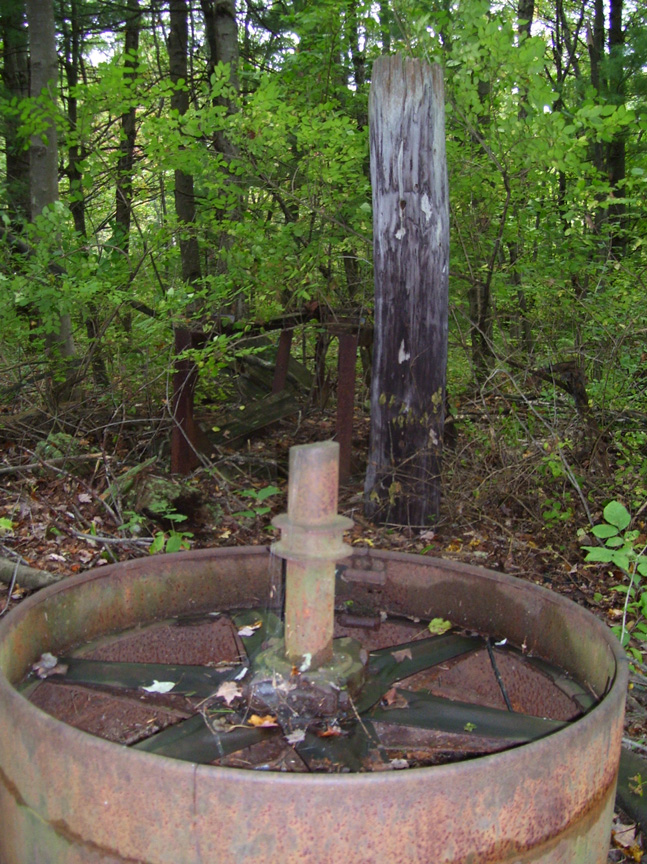
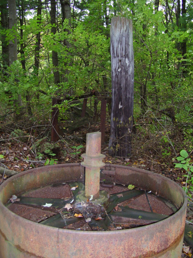
(Right - part of the rope tow machinery
at the bottom. Click on the image for a closer view.) |
 |
|
 |
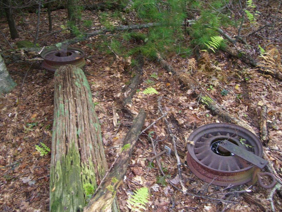
Pulleys for the rope tow
on the ground. These are likely 70 years old. Click on the image for the
larger version. |
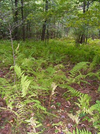
| The liftline for the rope
tow. Click on the image for the larger version. |
 |
|
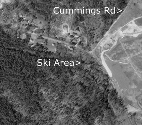 |
Here's an aerial view of Chalet
Hill. Note the liftline is barely visible just right of the > symbol. |
By the Year:
| Year |
Lifts |
Trails |
Other Info |
Source |
| 1939 |
900' rope tow |
30 degree slope, 200 foot
drop,
50-300 feet wide |
Located 9 miles north of
the center of Lowell (though this is not exactly correct), located on
Chalet Hill, NE Exposure. Needs 4" snow to ski at the intermediate
level. |
1939 Skier's Guide to New
England |
If you remember this area and have more
information, please let us know.
Last
updated: September 24, 2008
Head
back to Lost Massachusetts Ski Areas
Head
back to the main page