History Memories Current Pictures
Linda Hume used to work at this area and has some great stories to tell!
I have information about Sea View Ski Area in Rowley as my husband & I both worked there through many changes until it closed in the 1970s I will not include the names of people in case they do not want to be included. I moved full time to the family farm in Ma in 1964 we had previously just summered there, from Ct.
Sea View was located on Prospect Hill, a piece of property owned by a man who also owned one of the gas stations in town. He operated it as a ski tow with a rope tow until 1964 when he leased it to a NBPT couple. They operated a stable in the summer, a ski tow in the winter. The stable had an average of 8 horses that people could rent to trial ride for $2.00 per hour. That is the reason I started working there as I love horses I met my later to be husband there. The horses had names such as Pat, Judy, Dusty, Ranger, Kitty, Champ, Major, and Cinnamon. In the winter they went to the then Cardinal Cushing Academy in West Newbury where they were used for lessons horse shows etc & thus came back well trained! The owners of the stable, our bosses, took good care of the horses and insisted we do the same- even washed the saddle pads daily
There is a smallpox cemetery
in the woods along a trail that we were a bit spooked by We had to take boys
from Camp Rotary for rides every summer- the camp had a contract with the stable
to provide riding. There was also a small
pond on the area where we would take the horse for a swim. These
were some of my favorite times as a teen and I spent many hours in the saddle- a
horse crazy girls dream.
The new leasees installed a
T bar lift, which was a huge improvement over that rope tow! Snow making
was also added & the crew spent many the night up all night trying to get a
good base so we could draw more skiers than our rivals, Amesbury and Hamilton!
The slope was quite steep at
the top, then had a shelf then a more gradual bottom There were also trails to
each side which were kept pretty well groomed They had an active ski patrol of
which my husband was also a member and a racing team that did travel to other
areas & if I remember, did quite well. A local doctor headed and coached the
team.
There was a small ski shop rental shop, and restaurant, which served coffee, hot chocolate, soda, hot sandwiches and snacks. In the winter I worked behind the counter either selling food or tickets for the lift. There was a lesson program that had classes for both beginners to experts including children-- I sometimes got stuck babysitting !!
There was always a mini crisis- pipes for snowmaking broken, temperatures or humidity wrong to make snow, lift malfunction etc but all in all it was a fun time and the people who worked there were like family. In the late 60s the 2 men who had managed the ski tow/ stable ran it for a while but soon it was closed only to be opened up again by a couple who bred & showed Morgan horses. This was in the early to mid 70s.
They renovated the building previously used as a ski shop/ tack hut into a small house and added a small stable for their prize horses. He was a farrier and in the summer they relied on that and her income as a nurses aide. In the winter they opened the ski tow, this time my husband was the foreman. They once again had snow making and used a T bar The owner once had a screwy idea of using an air boat to power the snow making!! I still have a photo somewhere. Needless to say it did not work! Sadly this couple were not business oriented & the area did not stay open more than a few seasons IT was a whole different atmosphere- not the serious attitude with the racing team, organized ski patrol etc .
They have since divorced remarried moved and the buildings have long since been torn down. High price houses have been built to one side I read in the paper that they had to be careful to save the small pox cemetery. I have not gone back since I think it would me too sad.Don Dupray has
some more info as well: There were at least 3 buildings at the base, ticket booth, snack bar/cafeteria, and ski shop. The Ski shop was the predecessor to what is currently the Skol Sports shop in downtown Ipswich.
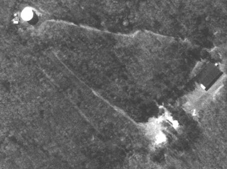
There were technically 3 slopes served by one T-Bar. As you stood at the bottom of the hill and looked up the middle or center slope, the T-Bar ran between the main slope and the slope to the right. The slope to the right actually offered 3 small jumps, wooden platform, the largest probably being 4 feet high. There were a lot of trees on this slope which offered a very early form of off trail skiing. The third slope, to the left, was maintained primarily for the Barrel Stavers ski club. I remember racing there on one occasion. They offered a giant slalom and down hill course.
There was also one semi-cross country trail that ran way out to the left, probably no more than 10 12 feet wide which connected back to the main area at the bottom of the left trail.
I do not remember when the area closed. There was no snow making. The T-bar as I recall was sold to another local area; either Amesbury or West Newbury.
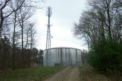
The water tower and cell towers that currently sit at the top of Prospect Hill are actually higher up on the hill than the ski area summit.
Some other NELSAP readers
remember this ski area. Here are their details:
Betsy McDonough's cousin Dan: Dan remembers that there definitely was one in Rowley. It's on 133 between route 1A and 95. It would be on your left heading west on 133. There used to be a restaurant across the street, but it doesn't exist anymore. He thinks there is a manufacturing place where the area used to be.
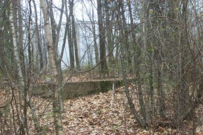
John and Linda Osgood: We went a little north to Rowley and found an old hill that his been closed since the mid '70s. The cement poured for the top terminal of the surface lift (type unknown) had 1971 as a date.
Bob
Morency:
Will
Bloombergh: Directions - To find this area, look for a wooden sign that
says Prospect Hill near a
small company called General Gear Co.
John
Brady: A ski area that I enjoyed as a kid was Sea View in Rowley.
It was in the mid to late 60's that I skied there. It was somewhat of a
center of junior racing activity, with an active local club running races on
most weekends during the winter. I recall that Becky Dorsey, who later
made the US team, did some of her early training there.
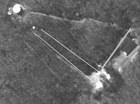
All of the information on the
sight is quite correct. I believe the lift line on the skiers left was a
rope tow and it was the primary lift. This is the line in your photos
marked with a white blaze. It is interesting that on the skiers right of
this lift line, there is a solid, straight line of old pine trees that in fact
define the line. They are old growth, so it puzzles me how these trees
came to be planted in a straight line. To the skiers right of these trees
was a trail that opened up into a slope about 1/3 of the way down the hill.
We ran races on this slope. The starter would stand at the top with a flag
on a pole. When he lowered the flag on a three count, a stopwatch would
start at the bottom and the racer would go. TAG-HUHER made no money on
this timing setup, but it developed good skiing skills, and a lot of kids had
many weekends of fun.
I think there was a second
tow that ran up the skiers right on the open slope as shown on your photo, but
here my memory becomes vague. The one on the skiers left defined by the
pine trees was the primary lift.
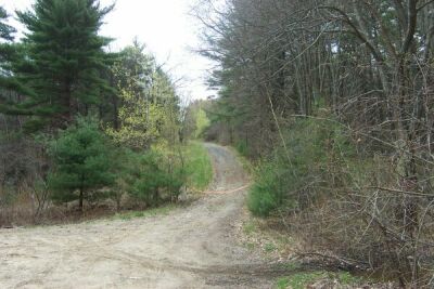
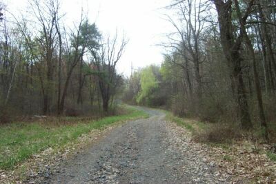
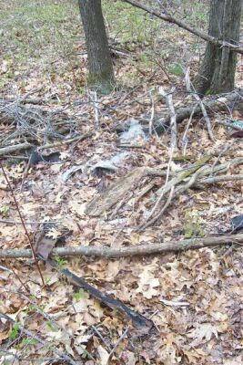
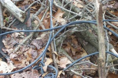
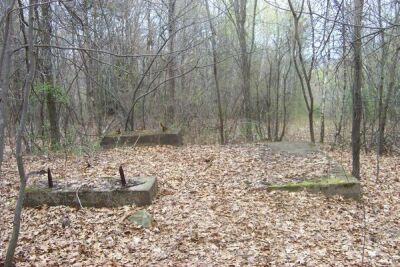
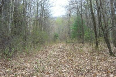
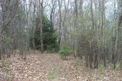
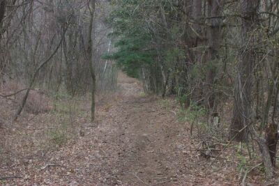
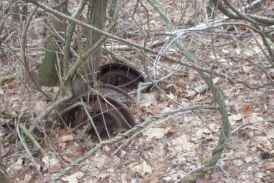
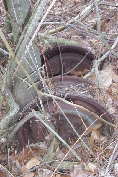
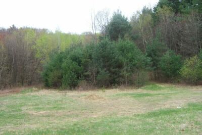
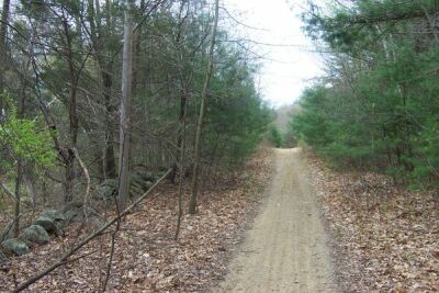
Steve Rheaume checked out the area on April 20, 2002, and wrote the following report. Great pictures!
Rowley
Ski Tow (Sea View)
April 20, 2002
Location:
Prospect
Hill is Behind 120 Haverhill Street (General Products & Gear Corp / Glynn
Motorsports)
Haverhill Street is Route 133. The Lost Ski Area is about halfway between
Route 1 and Route 1A in Rowley, MA
|
|
|
|
|
|
|
|
|
|
|
|
|
|
|
|
|
|
|
|
|
|
|
|
If you Hike any of these trails, be sure to check for ticks
after you are done!!!
Hunting is permitted per posted signs (no fire arms though),
so dressing in bright colors may be recommended during hunting season.
If you remember this area and have more info, just let us know.