Tinker Hill
Hadley, MA
1954-1964

History ~ Memories

History

Thanks to Chris Dixon, we now know of this area in Hadley. Here are his details and pictures:

I thought I'd let you know about a lost ski area near me that I hike up now and then. It's here in Hadley, Mass, on a small foothill on the north side of the Mt. Holyoke Range, which runs E>W (one of very few nationwide that do so!) across the Ct. River Valley. The hill is known as Tinker Hill and was used privately by the Amherst College ski club, and possibly as a practice slope for their ski team (the land is still owned by the college). Near 
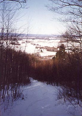
as I can tell, it operated from approx. 1954-1964. It was small, about 350' vertical (maybe another 100' skiable above the lift) with one main trail and one or two possible sidetrails serviced by a single rope tow. 
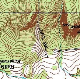
The ski lift is still marked on topographic maps of the area (USGS Mt. Holyoke MA Quadrangle). 

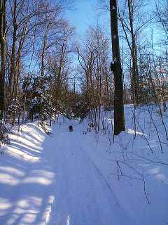
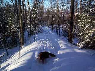
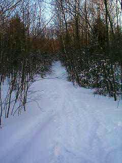
The lift itself is long gone, with only a wheel rim high on one tree, some sort of wooden hanger on another and a large cement anchor block at the top as physical evidence of same. The liftline, though, is still very clearly seen. The slope has grown in on the sides and washed out a bit in the middle but is still easily skiable (and, judging by tracks, known to more than a few area skiers, sledders and snowmobilers, so to be honest I usually seek my backyard freshies elsewhere!). 


A topo map of the area, looking up the slope.


Here's an overhead view of the area. Looks fairly well grown in. 
You can only barely discern the rope tow line.

I went to the Amherst College library looking for info but their archives had very little. There was a note saying the slope was developed by Professors Steven Rostas and J. Alfred Gues in 1952, but actual construction may have begun a little later. They had a blueprint of property lines surrounding the land dated 1/17/55 and a few black and white prints of a fairly newly-cut looking slope during the off season, all with ca. 1954 pencilled on back. I derived the 1964 guess from a notation on the archive folder, but all years are very rough guesses. I'm betting that they phased out using the slope when the larger Mt. Tom (RIP) opened just across the river in Holyoke ca. 62 (according to your site).


This first picture I have is looking up the old rope tow line from near the bottom. Note auto wheel rim from the old rope tow apparatus, attached to large tree at right. Also note Remy the Wonder Dog on trail!

This one is looking down the tow line from near the top. Remy the Wonder Dog again, in foreground!
This is taken from partway down the main ski trail, looking back uphill. Like my earlier (scanned) pic, we can see again how grown in it is. The original ski trail was likely as wide as, or wider than, the spread of the 2 large evergreen trees we see lurking in the background of this shot.

Here's a scanned pic from the top of Tinker Hill a few years ago. Looking approx NW with fields of Hadley and Ct River in distance. My ski tracks are visible, me having hiked back up to get the pic!

Memories

Ken Cuddeback: I used to train on this hill from 1968 - 1970 as a member of the Amherst Regional High School ski team.  By the time we used the hill, the rope tow was gone and we had to pack the hill out and hike to train.  It was a wonderful learning experience and certainly helped get us in shape for the season.  I'm not sure how many years after I graduated this practice continued.  The slope has a good pitch and was wide enough for a good training run and we could pack out several areas at once on the hill.   

Anybody else remember this area? If so, let us know.

Last updated: Dec 2, 2007

Head back to Lost Massachusetts Ski Areas

Head back to the Main Page