May Mountain
Island Falls, ME
Before 1973-mid 1990's

History ~ By The Year ~ Current Photos

History

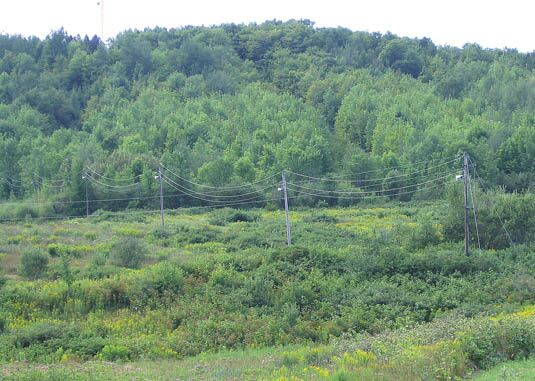
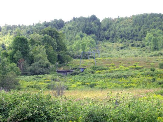
May Mountain is a recent lost area, having closed in the mid 1990's. It was a classic community type area for Maine - just big enough to be interesting, but otherwise 
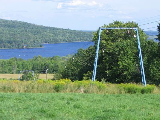
small and relatively isolated. It has spectacular views of nearby Lake Mattawaumkeag.

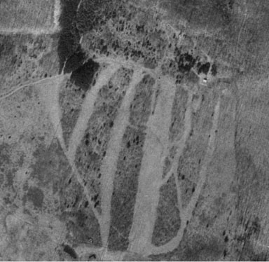
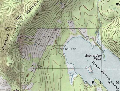
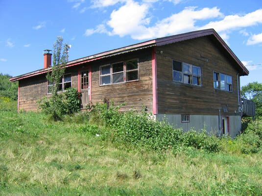
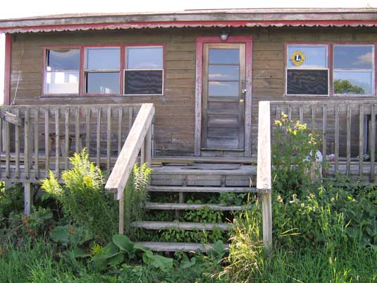
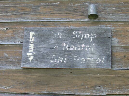
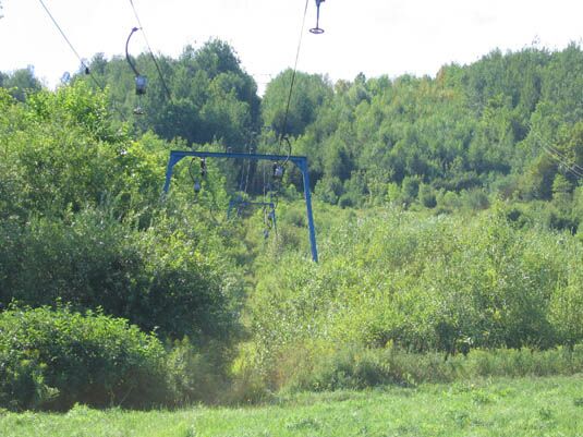
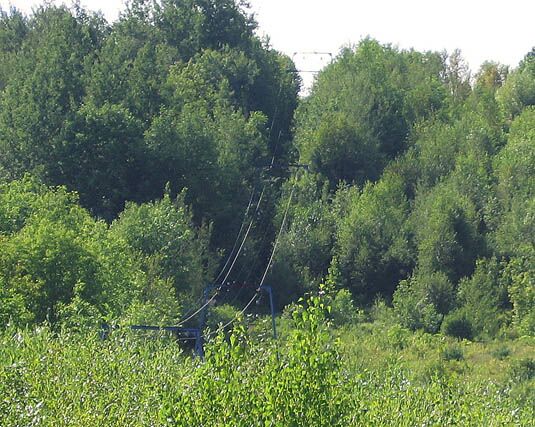
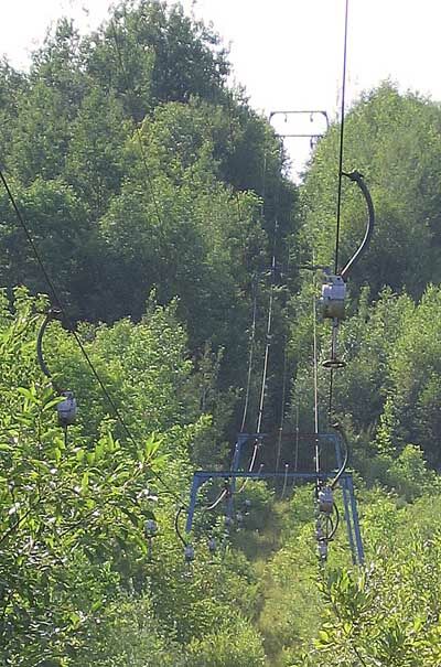
According to First Tracks, by Glenn Parkinson, the area opened in the late 1960's by two doctors who learned how to ski. The area had a 2800' long T-bar, and served about a half dozen trails. There was a steep headwall, then the trails flattened out. 

During the late 1980's, the area was run down and neglected, and was possible closed. The area was bought in 1992 by locals, who likely operated the area for a few years. May Mountain closed sometime during the mid 1990's. 

Losses like this for communities are tough - this area served as safe place for kids to learn to ski, and for locals to make some runs in at night and on the weekends. 

Since the area hasn't been totally vandalized or destroyed there is always the chance it will reopen. 

To the right is a Terraserver map of the area. Note the fall line trails, some wide and some narrow. The longest trail was 3/4 mile, the shortest about 2800'. 

Here's a topo map, from Art D. You can see the vertical here is about 400', and that it is located on Route 2. 

By The Year

Year Lifts Trails Other Info Source
Late 1960's T-bar Unknown Year opens First Tracks by Glenn Parkinson
Early 1970's 2800' T-bar 360' vertical Ski school, lodge, lunch counter, rentals Ski Maine Brochure
1973 1 T-bar, 1000/hr capacity 5 trails on 427' drop East exposure, Open Wed-Sat nights, weekends, holiday, school vacation weeks. Snack bar, rentals, warming huts, parking for 100 cars. No snowmaking or ski school. Rates: $3.50 adult, $2.50 junior. Season: $40 adults and juniors. Ski Guide to the Northeast
1977 Same 6 trails on 75 acres Ski school, rentals, snowmaking, low rates, night skiing Skiing USA
1982 1 T-bar, 700 skiers per hour Beginner to Advanced on 520' drop. Longest run: 3/4 mile Open Fridays and weekends.  Billy Kidd's American Ski Guide
Late 1980's Same Unknown Area is run down, neglected. Owners try to sell mountain First Tracks
1992 Same Unknown Area is bought by locals First Tracks
Mid 1990's Same Unknown Area last operates during this time First Tracks, but also based on tree growth

Note how the vertical "grew" during the years - the 427' reference is likely correct.

Current Photos

Art D visited the area during the summer of 2005, and took some great photos. Here's what he found, and his photos of the area:

"The former May Mountain Ski Area on Route 2 just northeast of Island Pond, Maine is on the east side of a mountain known as both May and Robinson. The ski area has a fantastic view of Lake Mattawaumkeag across Route 2. There is a 47 foot fire tower still standing on the 1025 foot summit. It appears to have about 400 foot vertical with wide open fields at the base and lights for night skiing. Above the fields are several trails that are growing in. The T-bar and Lodge still exist, although the T’s have been removed from the cable."

A view of the grown in trails from Route 2.

A look at the liftline - note how its grown in substantially, and that the upper trails are extremely grown in - all this in about ten years!
A shot of the lodge - it looked like it had been used somewhat recently.

Looking at the front door of the lodge - note the Lions logo on the window.
Sign reads "Ski Shop and Rentals/Ski Patrol", hanging on the lodge.

Closer look looking up the liftline - note the overgrown slope on the right.
Another look at the liftline.

And another shot - note that the T's have been removed, but the carriers remain.
Finally, a gourgeous shot of Lake Mattawaumkeag, looking down the T-bar lift line.

If you remember this area and have more info, just let us know.
Last updated: March 5, 2006

Head back to Lost Maine Ski Areas

Head back to the Main Page