Hawleyton, NY
Sometime between 1964 and 1967 - c1980
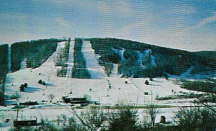
A view of the slopes from afar, sent by Alan Perrin from a postcard.
Innsbruck
USA
Hawleyton, NY
Sometime between 1964
and 1967 - c1980
A view of the slopes
from afar, sent by Alan Perrin from a postcard.
History By the Year Memories Current Pictures Directions
|
|
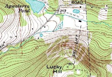
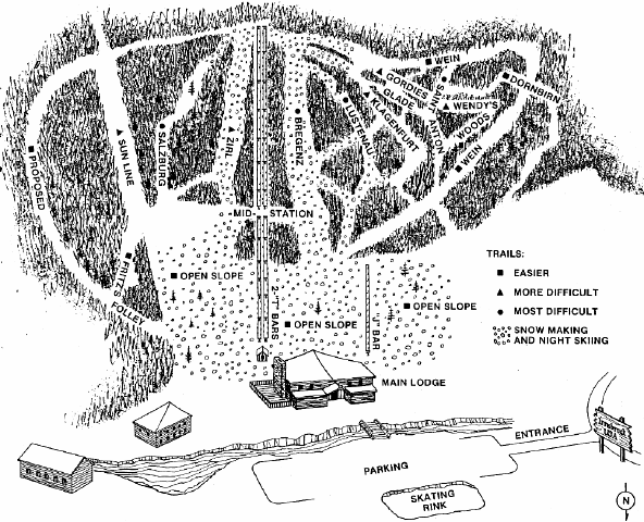
Innsbruck USA was a wonderful medium sized area with a wide variety of terrain for all skiers, just south of Binghamton. The area opened sometime between 1964 and 1967, and had expanded to 11 trails and 3 open slopes by 1972. 5 more trails or slopes would be added or renamed before the area closed. Several guidebooks claimed the area only had 9 trails and a few slopes, but other sources confirm 14-19 trails for much of its existence. Two side by side 485' vertical T-bars (with at least one having a midstation) brought skiers to the summit of Lucky Hill, where they could descend on such trails as the wide but steep Bregenz slope, or the easy winding Wein trail. A shorter beginner 150' vertical J-bar served a couple of open slopes near the base of the area. A cable tow or rope tow was added in the final years of operation. Snowmaking and night skiing covered a few major trails from the summit as well as the beginner open slopes, though for the first few years the snowmaking system was quite poor. |
| The area met an untimely end in the late 1970's, as the area could not pay its electric bills apparently. The power company just shut the power off and that was the end of Innsbruck USA. The equipment was sold off to mountains unknown. However, the ski area would find new life as Aqua-Terra park, a county or town owned area that is fully accessible and open to the public, great for hiking, picnicking, fishing, mountain biking, etc. Directions can be found below. |
|
| 1972
trail map, courtesy of Chris Shumeyko |
|
|
|
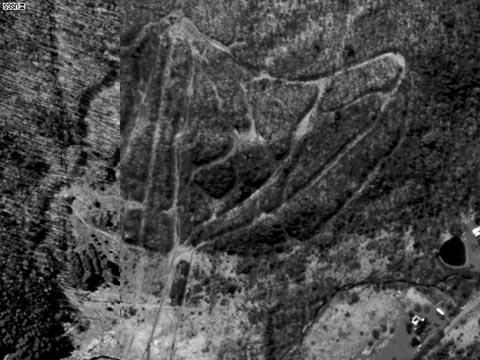
An aerial view of the trails today, still quite clear. |
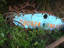
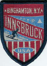
| A patch of the area from Alan Perrin. |
|
Please note that trail counts vary from year to year, but the 1972 listing is accurate. Sometimes the Eastern Trail Map was slow to update.
| Year | Lifts | Trails | Other Info | Source |
| 1967-1969 | 2 T-bars, J-bar | Slope, 9 trails, novice thru expert | Ski school, ski patrol, 1 packer, snowmaking | Eastern Ski Map |
| 1972 | Same | 11 trails, 3 open slopes | Skating, lodge | Trail Map |
| 1974 | 2 T-bars, J-bar | Slope, 9 Trails, novice thru expert on a 485' drop | Ski school, ski patrol, 1 packer, snow making | Eastern Ski Map |
| 1976-1980 | 2 T-bars, 1 J-bar, Cable Lift | 2 slopes, 9 trails, novice thru expert on a 500' drop | Northern exposure, ski patrol, 3 packers, cross country, snowmaking | Eastern Ski Map |
| 1977 | 2 T-bars, 1 J-bar, 1 rope tow | 19 slopes and trails, longest 1 mile | ATM and GLM ski school, medium rates, operatates Tue-Sun, snack bar, cocktail lounge, apres-ski, snowmaking, xc skiing. | Skiing USA |
Chris Shumeyko
The power company
just shut down the main T-Bar and the two rope tows to the open lower slope. The
area did have snowmaking and grooming which was very poor for the first couple
of years. The area is now a County Park called Aqua Terra which is fully open to
the public to go and explore the assortment of trails. The area is used for open
ATVing and mountain biking. When i visited the area I found the snowmaking pipe
for a long traversing trail. When reaching the summit you can see the wide open
area which housed the Summit of the T-Bar trails veer off in every direction
eventually ending up at the base. I also discovered the treads for the old
snowcat and the cement base for the lodge that was burnt down by vandals. The
ski area is located on Maxian Road in the Town of Binghamton in the Southern Tier
of New York.
The
main T-Bar
Chris Shumeyko
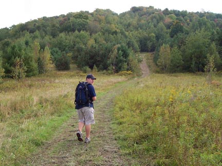
| Hiking up the mountain. Notice that some trails are certainly grown in. |
|
|
|
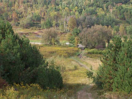
Looking down a slope to the base area. |
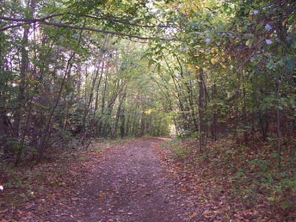
| One trail on the mountain. |
|
|
|
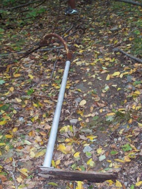
One broken half of a T-bar, lying on the ground with the haul rope. |
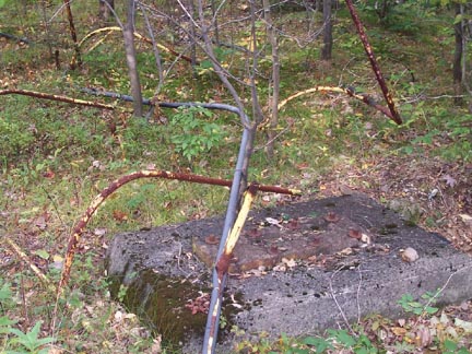
| Cement foundation for the T-bar lift. |
|
|
|
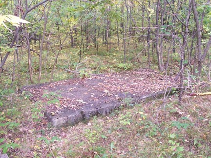
More foundations. |
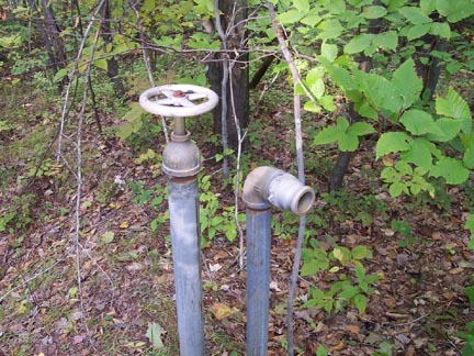
| Snowmaking nozzles. |
|
Directions: OK, you’re in the mood to climb one of these good size
hill
around here, or maybe just to be next to one, how do you find this
If you have more information on this area just let us know.