History ~ By the Year ~ 2004 Visit ~ 2006 Visit ~ Memories
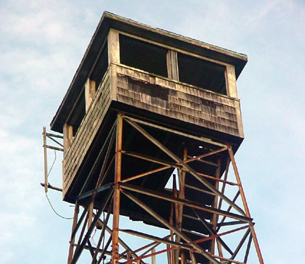
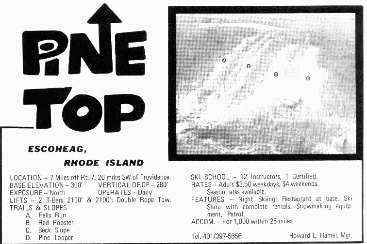
Pinetop ski area in Escoheag was a classic New England T-bar ski area that opened in the middle 1960's and closed in the early 1980's. Two t-bars and two rope tows originally served this mountain, though in later years the rope tows did not show up in any guides. During the middle 1970's, it had as many as 20 instructors, so I'm sure many locals learned to ski here.
Today the area is owned by state and can be explored freely.
Below is an early 1970's trail map, showing the various slopes and liftlines. You can see some what narrower trails (Falls Run and Red Rooster) on the right, and two wider slopes (Beck Slope and Pine Topper) on the right. Both had t-bars that split those areas up the middle.
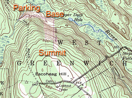
| To the right is the topo map of the area, annotated by Art D. You can see that the advertised vertical of 280' matches up well with the map. |
|
|
|
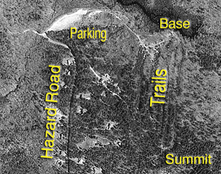
The aerial Terraserver shot (annotated by Art D) shows the location of the area off Hazard Road. Note that on this map, the trails look fairly grown in. |
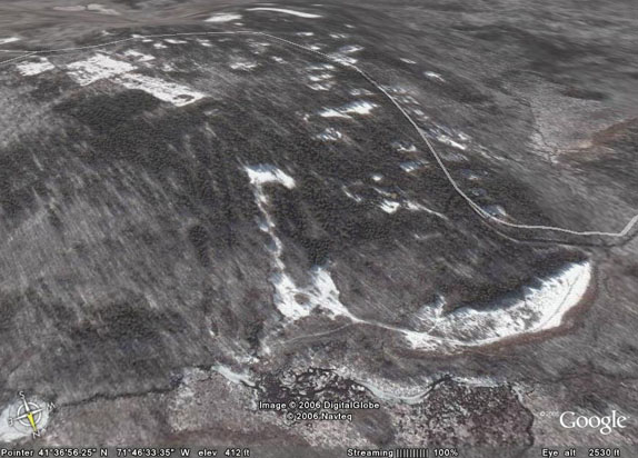
| This Google Earth Map, from Jon Regan, shows the area clearly. Note how the Beck Slope is fairly clear, but the other trails have grown in more. |
|
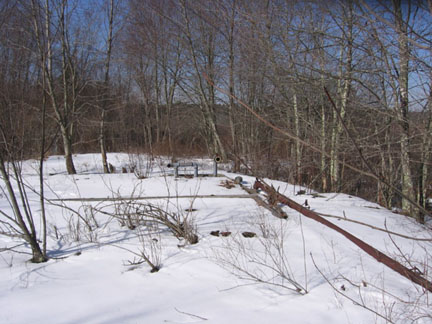
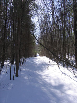
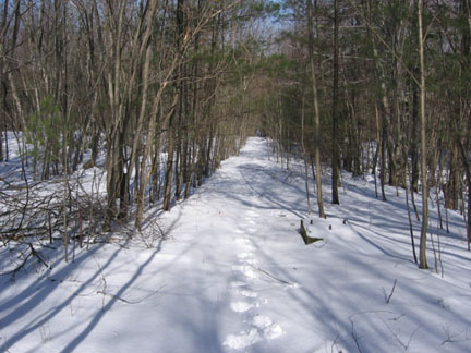
Two NELSAP enthusiasts (Art D and Jon Regan) have explored this area in both summer and winter. Their pictures are below.
Art D visited the area during the summer of 2004 and found out quite a bit. He took the following pictures and gave us the following information.
| The
ruins of Pine Top Ski Area are located on Escoheag Hill in West |
|
|
|
The
land is now owned by the State of Rhode Island in the Arcadia Management
Area. |
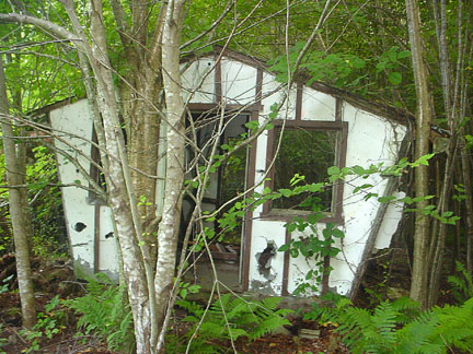
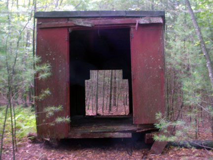
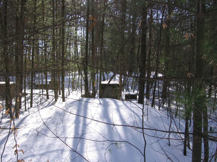
| There are the ruins of a warming hut (right) and a few snowmaking pipes. |
|
|
|
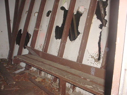
A view inside the warming hut. |
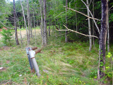
| Snowmaking pipes still exist. |
|
|
|
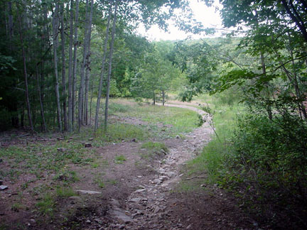
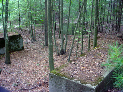
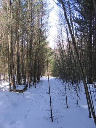
Heavily eroded trails |
| Northwest of this point, at a point between the top |
|
|
|
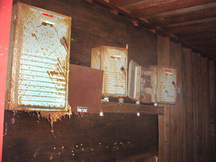
The circuit breakers, quite rusted. |
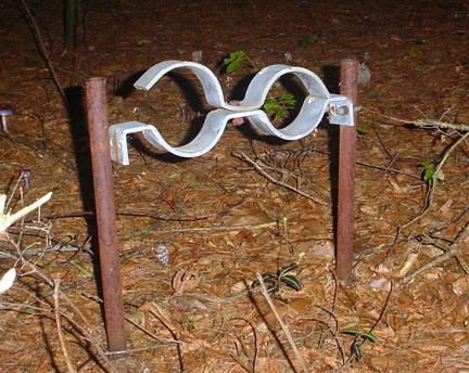
| The snowmaking brackets. |
|
|
|
I wish I had had a chance to ski it in it's
heyday, it is an interesting area. It's also amazing how reforested this area Although,
it’s not part of the ski area, at the top of Escoheag Hill across
|
| The remains of the snowmaking plant. |
|
|
|
Looking up the T-bar line. |
| The view looking halfway down the T-bar line. |
|
|
|
The summit of the lift line. |
| Summit foundations for the lift. |
|
|
|
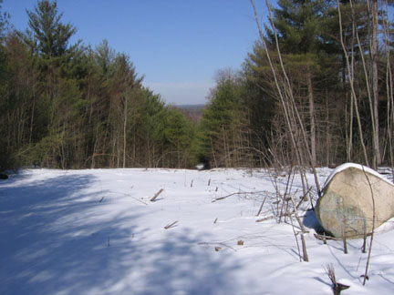
Looking down a slope. |
2017
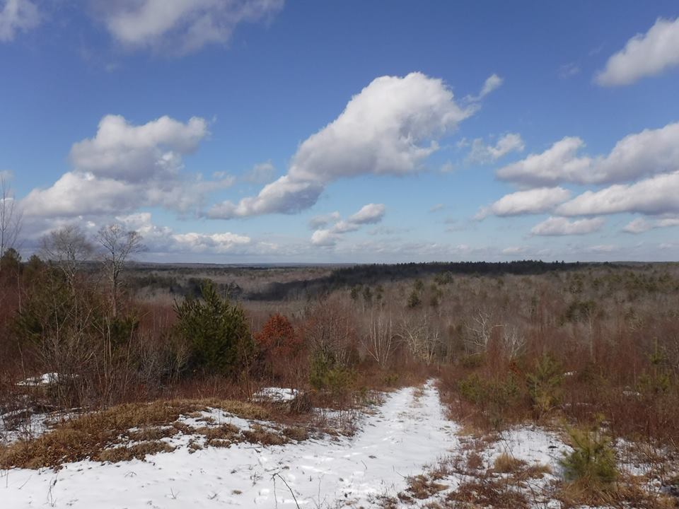
| View from the summit, Feb 2, 2017. Courtesy Michael Bradley. |
|
| Year | Lifts | Trails | Other Info | Source |
| Before 1965 | Unknown | Unknown | Opens around this time | Judy Pettini |
| 1969 | 2 T-bars, 2 tows | 4 slopes, novice through expert | Ski school, packer, snowmaking | Eastern Ski Map |
| Early 1970s | 2 2100' T-bars, 2 tows | 4, Vertical drop 280' | 12 instructors, $3.50 weekday rate, $4.00 weekends, night skiing, restaurant, snowmaking, ski patrol. | Ad from Dave Hilton |
| 1973 | 2 T-bars, 1000/hr capacity | 3 trails, 280' drop, north exposure | $3.50 adult weekday, $4.50 weekend. Season rates: $90.00 first family member, $60.00 second, $40.00 third, $30.00 each additional. Ski school: American technique, 20 instructors (4 certified). Parking for 300 cars | Ski Guide to the Northeast |
| 1979, 1980 | Same | Same | Patrol, ski school, packer, snowmaking, night skiing | Eastern Ski Map |
| 1981 | Same | Same | Closes around this time | The Colorado Skier Newsletters |
John writes:
"I skied Pine Top many a time during the 1970's with my father and two
brothers. It's trails were pleasant but not particularly steep. The nicest thing
about it was the pine glade at the top (hence the name). Skiing thru it you felt
a bit like you were farther north in N.H. The leftmost trail on the map seemed
to be closed a lot. Occasionally my brothers and I would sneak on it just to ski
something different. The t-bars were easy but kind of slow. I seem to remember
the lodge as being fairly nice."
Chris: I was an instructor there for a couple of years back in the late 70's when I attended URI. I still remember driving up Rt 102 to get there from URI, and I also remember the Double Pine Tree at the end of Rt 102 at the Rt 3 intersection. That Double Pine Tree is still there, just a little bigger now.
Judy Pettini: I was just reading your article about good, old Pine Top. We spent many fun hours there while we were in High School. Lot's of great memories! As I mentioned, I skied it while in High School. Since I graduated in 1965, I know the area operated before that time. I don't remember when it closed. By then I was skiing at "big" mountains.
Last updated: March 1, 2017