History Listings by the Year Personal Stories Pictures
History
Berkshire Snow Basin
was located on Route 9 in West Cummington, MA. It was founded by Ruth and Stan
Brown in 1949 with just a few rope tows on a 550' drop. In 1961, a much
longer T-bar replaced two connecting tows, allowing a much easier ride to the
summit. A large expansion took place in the between 1964 and 1968, adding 2 more
T-bars, and new trails and slopes bringing the total up to 11. The 1980's
brought changes in ownership, financial issues, a brief closure, and aging
infrastructure, and Berkshire Snow Basin closed in 1989.
The area was your typical small, family type area, with a modest amount of affordable skiing. Its a real shame it closed, as it was fairly large and had a decent blend of trails and slopes.
The Snow Basin is one of the most enjoyable areas to explore -with a small parking lot, semi-clear trails, and plenty of remnants, and it is on public property. Be sure to check it out and send photos!
We have plenty more additional information, so look for more updates in the future.
Berkshire
Snow Basin Listings by the Year
| Year | Lifts | Trails | Other Info | Source |
| 1951-1952 | 2 tows | 2500' run | 550' drop, lunch bar, ski school, rest rooms | Eastern Ski Map |
| 1950's | 4 tows | 7 trails and slopes | See trail map below | Brochure from Ski Museum |
| 1961 | 1 T-bar, tows unknown | unknown | T-bar added, according to a Doppelmayr Report | Doppelmayr Report |
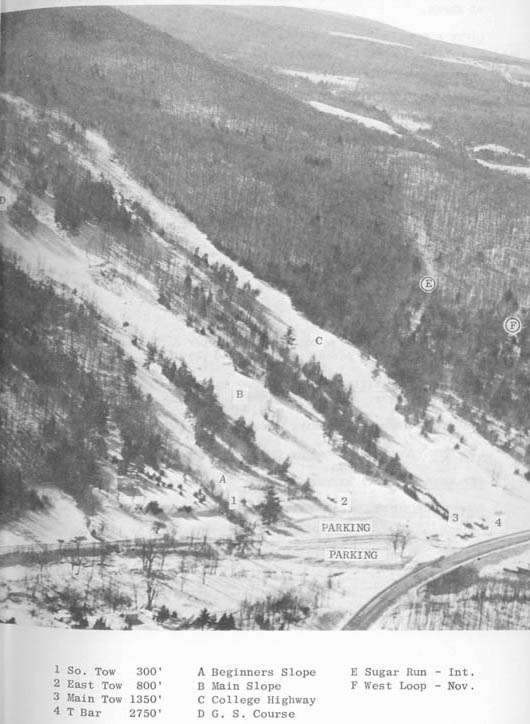
| 1963 | 2750' t-bar, 3 tows (300'-1350') | 3 intermediate runs (similar to Standard at Stowe), 3 novice, 1 beginner slops and trails | Operates Sat-Mon, holidays, and school vacations, ranging from 50 skiers on Mon to 500 on Holidays. Open Mid-Dec to end of March | Buxton's Ski Guide |
| 1964 | T-bar, 4 tows | 3 slopes and 3 trails | Ski school, packer | Eastern Ski Map |
| 1968 | 3 T-bars, 1 rope tow | 4 trails, 2 slopes, 11 acres total | Base elevation 1180', NE Exposure, "Modern Ski Lodge with Fireplace", operates daily | Unknown Ski Guide |
| 1971 | 3 T-bars, 2 tows | 5 trails, 3 slopes, 1 novice trail | Lodge, ski school, snow-making equipment, ski rentals, snack bar, ski patrol. Open daily | Massachusetts, a Guide to the Pilgrim State (provided by Betsy) |
| 1973 | Same, 4000 per hour capacity | 11 trails | Operates Wed-Sun, ski shop, snack bar, warming hut, 250 car parking lot, no snowmaking or night skiing. Ski school: Howard Redpath, Director, American Technique, 25 instructors (15 certified). $4.00 adults, $3.00 junior weekdays. $6.00 adult, $5.00 junior weekends. | Ski Guide to the Northeast |
| 1979, 1980 | 3 T-bars | 8 trails, 3 slopes, novice thru expert | none | Eastern Ski Map |
Clark
Ziegler "Berkshire
Snow Basin in Massachusetts was a family business from start to finish.
The founders were Stan and Ruth Brown, both of whom were top ski racers
in the 1930s. Before they were
married Ruth was a member of the U.S. Women's Ski Team and Stan was her coach.
They hiked up and took snow
Brian
O' Malley: I
talked to Ken Cyr from Cummington Ma. today, about his memories of Berkshire
Snow Basin. He had quite a bit to say......mostly that it grew into a nice
family area w/longer tbars--had a outside trail just under a mile long...no
snowmaking....he ran the ski
Eric Klein: I grew up skiing at Berkshire Snow Basin in W. Cummington, MA during the mid to late Seventies. I recall that Ruthie's Run (named after Mrs. Bown) had a few quick drops that made it exciting.
Pegasus533:
Ken
Cyr was the last Patrol Leader at Berkshire Snow Basin in W.
Skip Wallace: I had the pleasure of skiing at Berkshire Snow Basin only twice but I have indelible memories of both trips. Back in about 1977 or '78, I had given my twin nieces and three nephews a ski trip for Christmas. Just out of college myself, I needed a place that was VERY inexpensive and close enough to our home in Connecticut for a day trip. We were originally headed up to Hogback (another defunct ski area in Vermont) but car trouble intervened and we ended up going to Berkshire Snow Basin which was about an hour closer in the Berkshires of Massachusetts. The base lodge was rustic to say the least, with a gravel floor and a large circular fireplace in the middle. All of the lifts were T-Bars as I recall which provided us with several hours of amusement as we watched the boys (who had never skied before) trying to master the art of riding these beasts! It was like being at a roman circus as my future wife, my nieces and myself chortled at their headlong plunges into the snow every time the lift attendant let go of the bar behind them! Despite this rather ignominious beginning, the experience sparked a life long passion for the sport with one of my nephews, Tim, who is now my primary ski partner.
The second trip was in February, 1988. Once again, I needed a place close to home and cheap. This time, I had a much better opportunity to get a feel for the terrain as we skied hard all day. For a 500' vertical T-Bar area, I was struck by its big mountain feel. Several of the trails where quite steep and they had a fairly long and challenging gladed run (at a time when such runs were quite rare in the East).
I'm told by a friend who has been a long time member of the Hartford Ski Club that the club used to maintain a lodge across the street from the area in addition to their other lodge at the base of Mad River Glen. This is not surprising in that Berkshire Snow Basin in may ways was like a miniature Mad River - a rustic and challenging skiers' mountains with an abundance of tree skiing and a risky reliance on natural snow cover. As our sport becomes more and more homogenized each year as small areas continue to go out of business and the larger areas are gobbled up by faceless conglomerates, let's hope that the few remaining ski areas with true character like Mad River can find a way to avoid becoming just a memory.
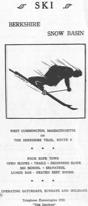
| 1950's ad. |
|
|
|
Here's
the trail map from a ski brochure provided by the New England Ski Museum),
circa 1950's. To
see the cover of the brochure, click here.
Otherwise, here's
the trail map and descriptions for a brochure from the 1950's.
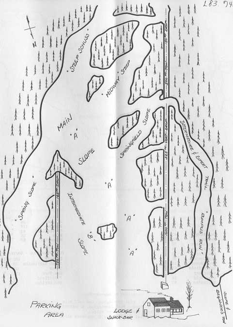
A True Snow Hole Lifts: Upper tow, 500' long, 150' drop; Lower Tow, 1600' long, 325' vertical; East Tow, 750' long, 165' drop; and Beginner's Tow, 400' long. Trails: A. Main Slope, Intermediate and
Advanced, 1600' X 250', "A recreational area with sporty
terrain." |
Trail map to the Snow
Basin from 1963: Click on the lower 3 (base of T-bar) to see what the area looks like
today! (photo courtesy of Betsy McDonough)
|
|
|
|
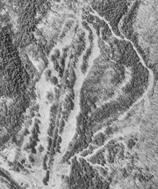
Berkshire Snow Basin
as it appeared in 1992 (Microsoft Terraserver).
In 1992 there was very little growth on the slopes, though this has certainly
changed now as most of the trails have grown in substantially. |
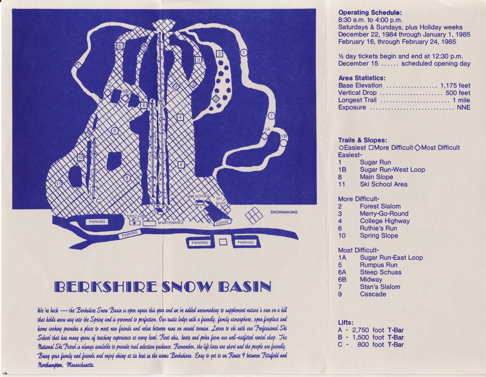
| A 1984-1985 trail map of Berkshire Snow Basin (click for full scale version). Note that the area had reopened after closing for 1983-1984. Snowmaking had been installed on a majority of trails. Lift B, a T-bar, was likely removed around this time, as it was not there by the time the area closed in 1989, and is definitely gone as of 2014. |
|
|
|
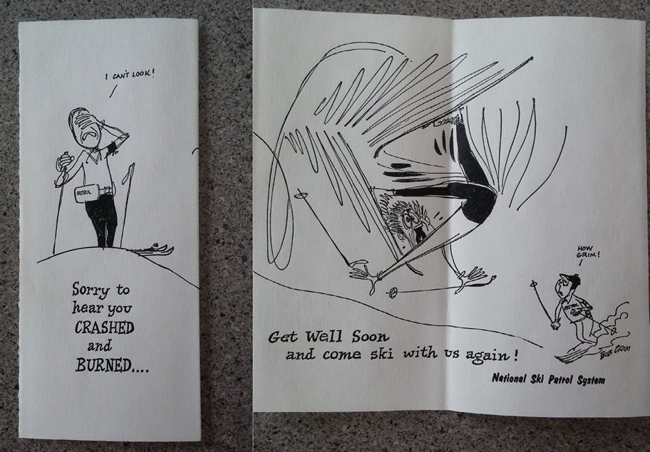
A get well card that Ski Patrol members would send to an injured skier. Courtesy of Steve Moulton. Click for larger version. |
2006 Photos
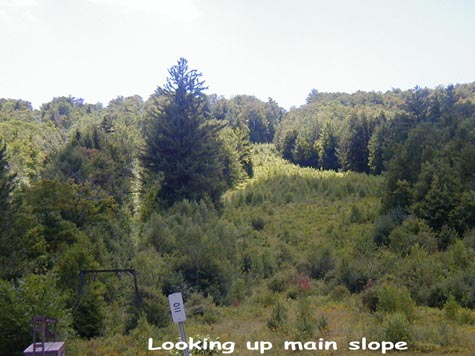
| A view looking up the mountain. Main summit T-bar still stands. College Highway Slope is on the right. Picture thanks to Bill O'Meara. |
|
|
|
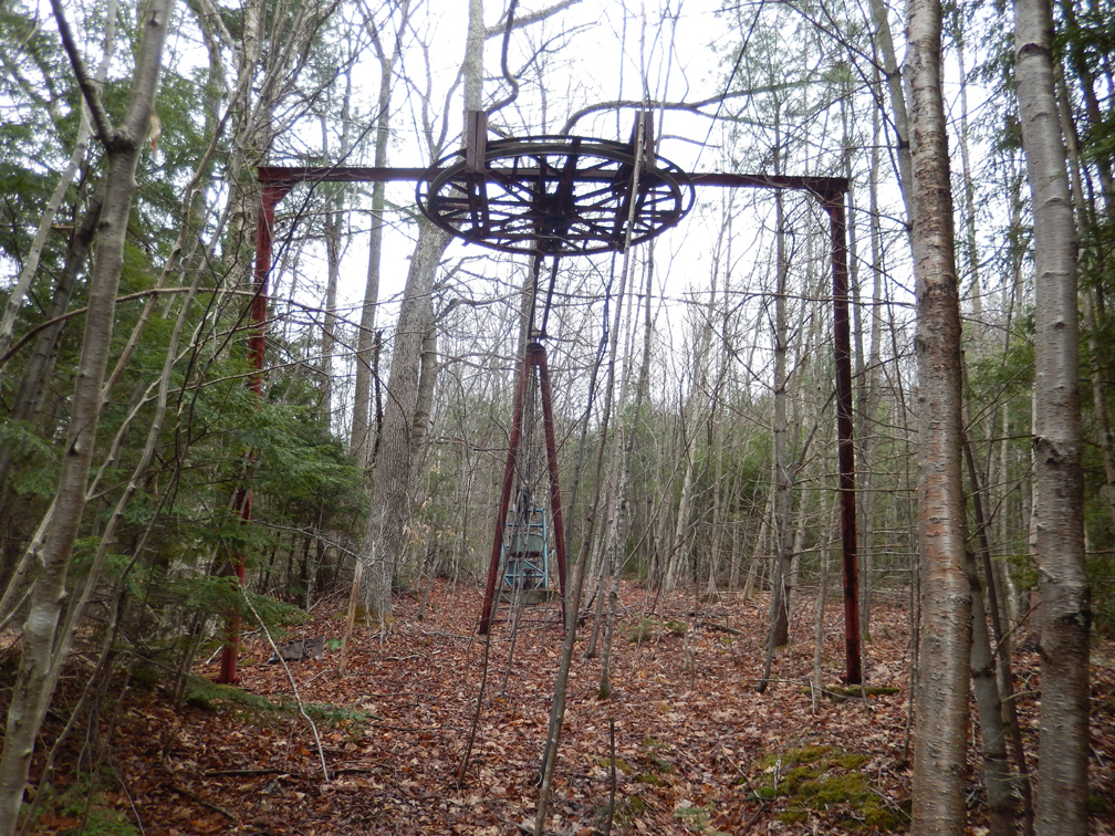
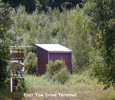
The East T-bar Drive Terminal, thanks to Bill. You can see the T's inside (picture is overlapped). |
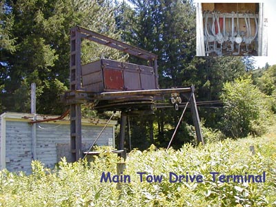
| A closeup of the Main T-bar Drive Terminal. You can also see the actual bars here too. Picture thanks to Bill. |
|
2014 Photos
Thanks to Ian Ciesla who sent us several shots of Berkshire Snow Basin in the winter. Click on each for a larger version.
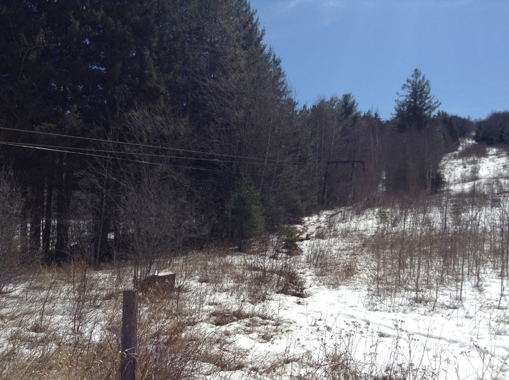
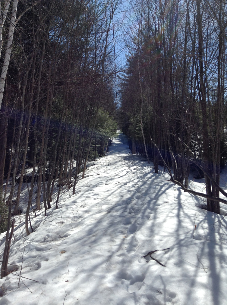
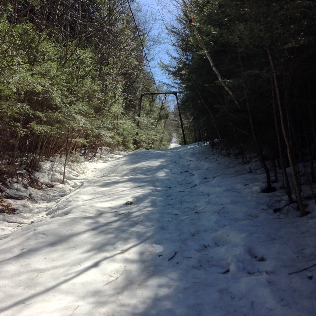
West (Summit) 2750' T-bar
 |
 |
 |
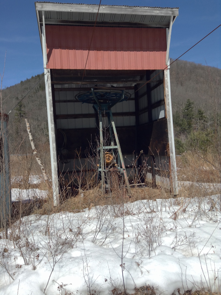
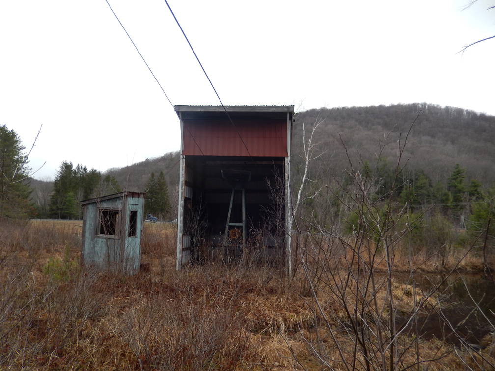
| Drive and operator's building. |
Looking up the liftline from the base. Note the College Highway slope on the right is still partially clear. Massachusetts DEC keeps to cleared now and then. |
Looking down the lower liftline. |
 |
 |
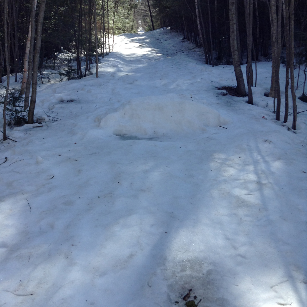 |
| Liftline. | Liftline. | Jump on the liftline. |
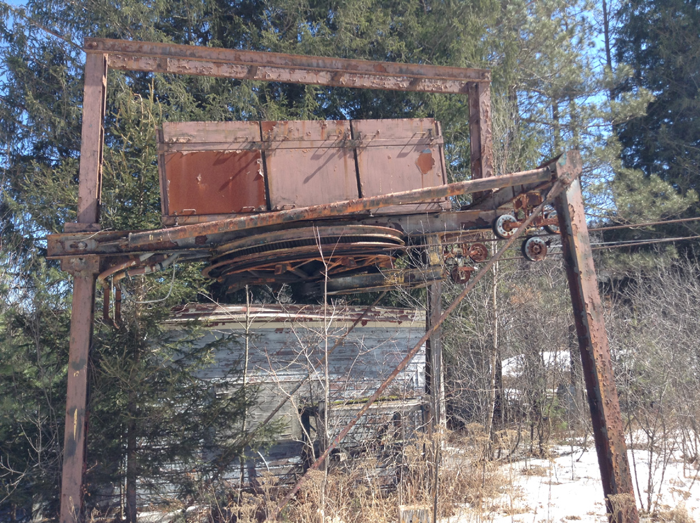
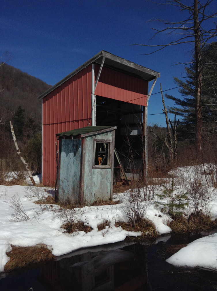
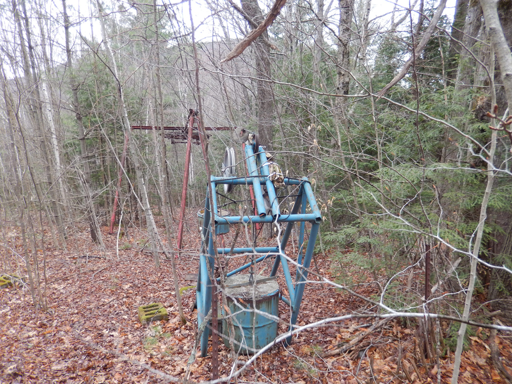
East (Beginner 800') T-bar
 |
 |
|
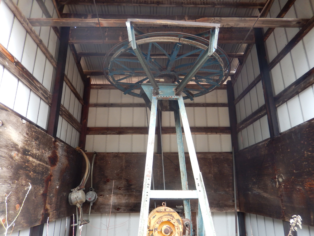
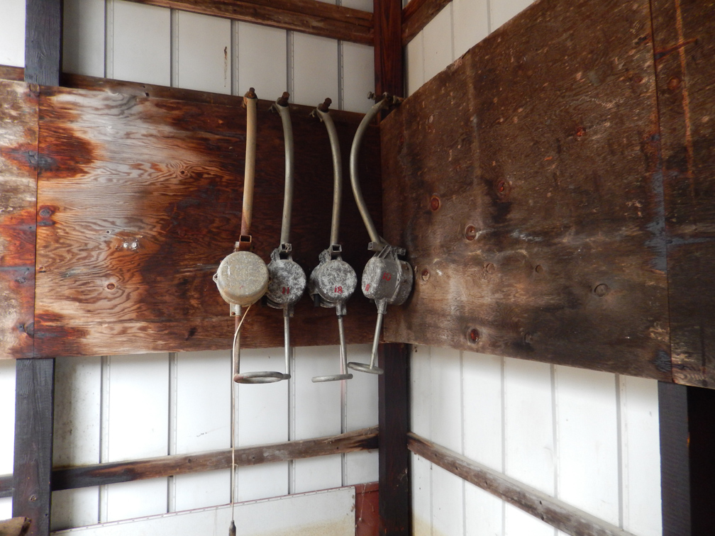
Drive station and operator's hut. Still in very good shape after 25 years of closure. Periodic flooding from a nearby beaver pond can limit access. |
A view inside the building. |
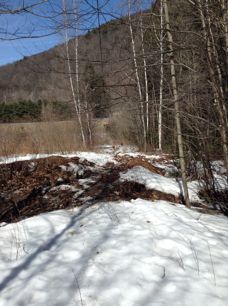
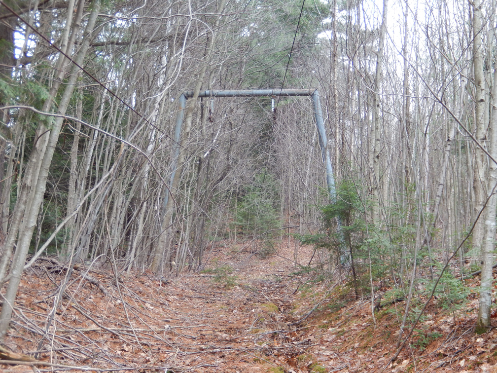
April 23, 2014
I (Jeremy Davis) visited the area on April 23, 2014 while being interviewed for a segment on lost ski areas for WGBY TV, Springfield. We hiked up the East T-bar liftline and took photos. We also noticed that a tree had partially absorbed a rope tow pulley from when the liftline was a rope tow in the 1950's.
Rope Tow Remnant
| This tree has absorbed the former rope tow pulley. |
|
East (Beginner) T-bar
|
|
|
|
|
 |
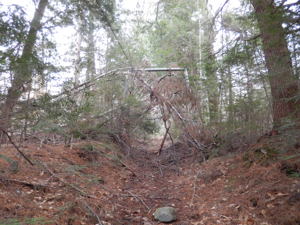
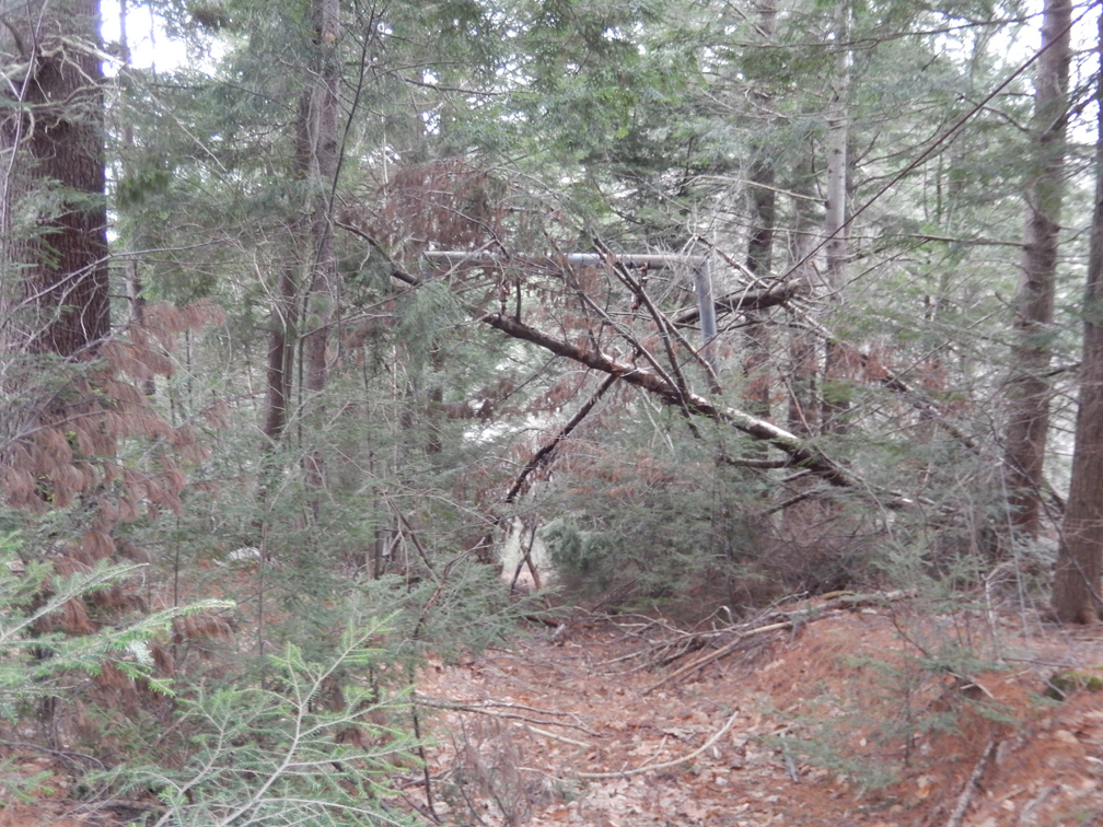
| Interior of drive station. | A few T-bar carriers remain. | Operator's hut and drive station. | First tower up the liftline. | Liftline through the trees, note cable. |
 |
 |
 |
 |
 |
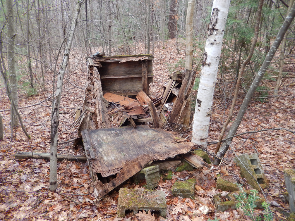
| Tower surrounded by fallen trees. | Lift tower. | Summit operator's hut, collapsed. | Return station in good shape. |
View of the return station/counterweight. |
If you have further info on this area, just let us know.
Last updated: Jan 2, 2015
