Kopola's Tow
Asnebumskit Hill
Paxton, MA
?-Around 1975
NELSAP
first heard of this small rope tow area from A.Hamilton,
who told us that the area was located on Asnebumskit Hill
in Paxton. He told us that the exact latitude, longitude
was Paxton: 42.18.80 N 71.54.32W.
We also
heard from Ken Lubin who had this additional information and
directions: To find this area, go down Rte #31 from
Paxton Center and take a right at Bel Air Rd or Ave. Go
to the end and there is an old parking lot where the hill
then goes up. Co to the top of the hill and there is an
engine and rope tow towers. There are a couple trails. It
is a very famous place in Worcester for mountain biking.
Here's an
overhead view of the area...not much left.
|
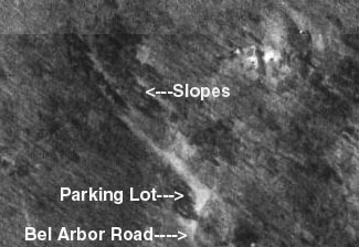 |
Kevin Beach
used to ski here: The ski area in Paxton, MA (Kopola's, actually spelled
Kauppila) was never open to the public. The father built it for his
children and their friends. I lived on Asnebumskit Hill and skied there a
number of times while in grammar school. The trails facing west were very
steep (but short) but the west exposure melted the snow quickly. Because
the family business was welding, the rope tow towers were steel, rather than the
usual old telephone poles, and they did have some basic home built, but clever,
grooming equipment. I never skied there again after going to high school
and I believe it was not used much if at all after 1975.
Kopola's was not the only ski area
on Asnebumskit Hill. During my grammar school days (1964-1968) another ski
area existed on the other side of the hill. This area was the brainchild
of Stan Miller from Paxton who, with help from all our fathers, cut 2 ski trails
from the top of the hill down to a corner of the neighborhood near its base.
There was a road to the top of the hill to service the radio and TV stations
located there at the time providing car access to the top of these 2 trails.
Stan made a special ski rack which hung off the sides of his station wagon and
we would stuff our skis in them and he would drive us to the top. We would
put our skis on and fly down the hill, where Stan would meet us and lug us back
to the top. Often our first trip up would be side stepping the entire
length to pack the new snow (oh, yeah, we kids just LOVED that part), but the
runs back down were terrific. The trails were classic New England, narrow
and wooded all the way. As we entered high school, we all were skiing
every weekend at local ski areas (Pine Ridge for must of us) and we no longer
skied on these wonderful trails. They still were a great place to sled for
years until I moved away to college. This is public land and the last time
I was up there it was still possible to see the trails.
Kevin
Thomas and Steve Bongiorno also told us of this area.
After reading about
this area Laurie
P. decided to take a visit
and check it out. Here is what she had to say: I spoke to a
neighbor of the area and he said that the area had 1 Rope
tow, 3 slopes/trails, but he really didn't know much else about
it, as it had closed prior to his moving into his house. He told
me that people go in there all of the time and it is a favorite
place for mountain bikers and four-wheelers and warned me that
three four-wheelers had just gone into the area.
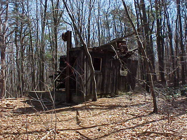
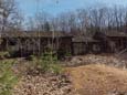
As I explored the
area I made the following observations: a building that
appears to have been the lodge, some old related and unrelated
machinery, rope tow towers with wheels intact, the motor house at
the top, some pieces of wood that looked as if they may have once
been signs, no evidence of lights, no evidence of snow making.
The area is at the
end of Bel Arbor Lane which is about 3 to 4 miles away from Anna
Maria College on route 31 as you head toward Holden MA.
Currently, four-wheelers use the area, there were three there
when I stopped. As I entered the little dirt road that seemed to
go into the area I saw several piles of rusted metal and other
rubble, some of which may have been from the ski area. Not too
far in the road, I came across an old abandoned building to the
right of the ski lift. The road was actually driveable, but I
chose to walk in not knowing what I would find as I got deeper
into the area. One wall was completely missing on the building
and the interior was completely gutted. In front of the building
there were two newer vehicles each with a trailer for carrying
four-wheelers, but no signs of the four-wheelers. Behind the
building there were several old abandoned cars and trucks, which
did not seem related to the ski area. Below that there was a maintenance shed with several gas cans, motors and car and truck
parts piled up. It was nearly impossible to get to the shed to
look inside. Inside the shed there were more motors and parts,
nothing that looked as if it were part of the ski area. This may
have been another business run by the people who ran the ski
area.
After snooping
around there for a while, I decided to explore the rope tow and
the hill. All of the pulley wheels and rope towers were still
standing on the hill. Some of the trails were still relatively
clear due to the four-wheeler and mountain bike traffic in the
past few years. I decided to walk up the trail to the left of the
rope as you looked up the hill. The hill started of fairly
gradual, but became steeper as I ascended. As I walked I could
see from the new growth and brush in the area that it was
actually quite a bit wider than the current paths. Just before
what appeared to be a split in the trail, I noticed old pieces
of wood, they may have been signs, the other side was painted,
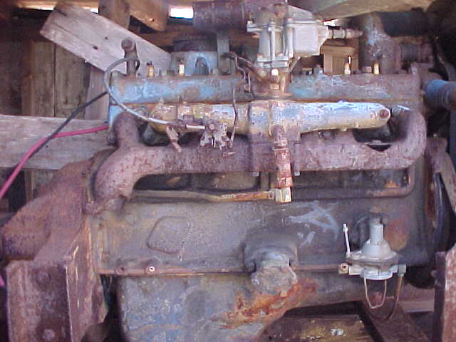
but I could not make out what they said. When I got to the top, I
found the top shack still intact. The motor was still in it's
place. Looking at the top wheel, it appears as if the up hill
rope went into the building in the front then came around to the
back and up and over this wheel to head back down the hill.
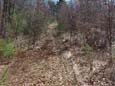
I decided to take a
different trail back down the hill. This was a steeper slope. It seemed to
be a narrow, windy trail and looked as though it might have had a
tree here and there to ski around as you went down. For
this area, it was probably their black diamond trail. At one
point this hill was so steep and had so many loose rocks that I
had trouble keeping my footing and had to cross over to the
center trail with the rope tow on it.
Laurie's Photo Album, with pictures taken in
March of 2002. Click on each picture for the larger version.
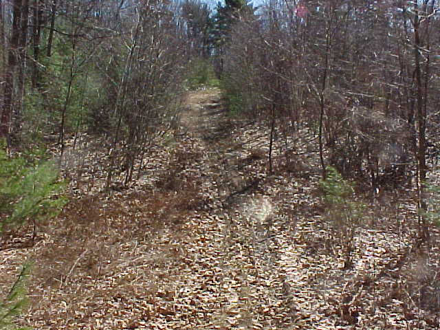
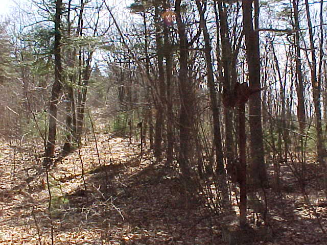
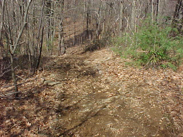
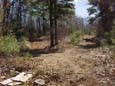
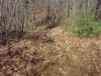
A path
leading up the hill (to the left of the tow rope as you
face up hill.
|
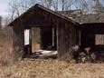
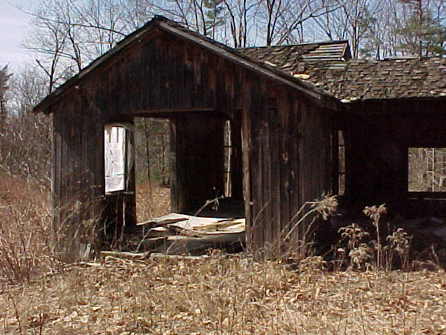
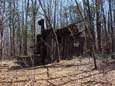
The
building next to the ski slopes. I believe this was
probably the lodge.
|
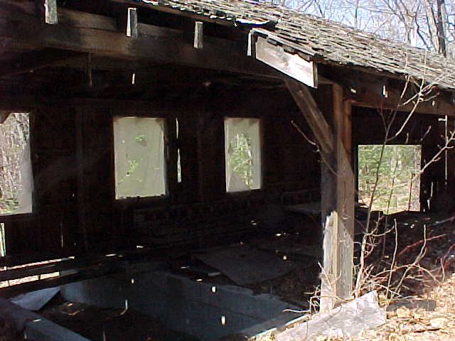
The
interior of that same building from another angle.
|
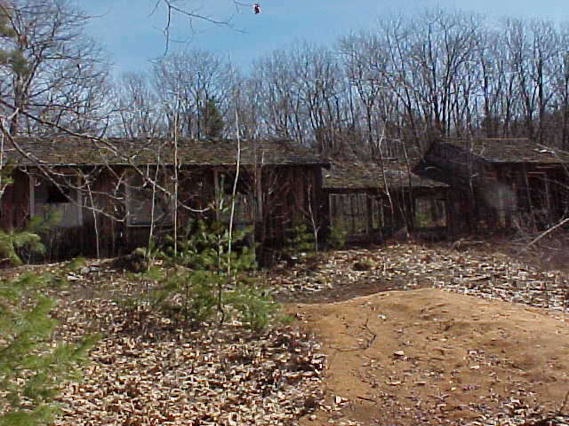
The same building from the
back.
|
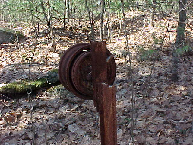
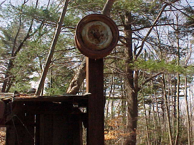
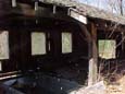
The bottom of the rope tow.
|
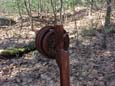
First wheel
after the base of the rope tow. Notice how low it is to
the ground.
|

Several of the rope towers
going up the hill.
|
Looking up at a split in the
trail. Notice the pieces of wood that may have been
signs.
|
The rope tow shack at the top
of the hill.
|

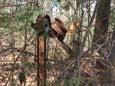
The motor for the rope tow.
|
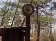
The top wheel on the motor house.
|
A trail through the woods, notice the
bend to the left then back again to the right
|
There was a fence
piece attached to a pipe with cotter pins at each end that looked
as though they may have been part of some early grooming (drag)
device. I had taken pictures of it but unfortunately, I
lost that disk somehow. In the pictures, the area does not
look very steep, the two side trails were quite steep in some
places. I would say that the rope had to have been 1000'
long at least.
Head back to Lost MA Areas
Head back to the Main Page