|
|
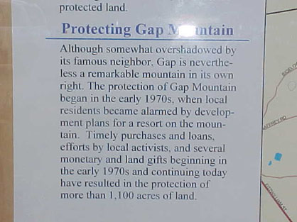
Apparently, there were plans to develop a resort on the mountain in the early 1970's. This could have been a ski area, or perhaps something else. |
Gap Mountain
Tow
Troy, NH
1948-around 1950
Gap Mountain operated briefly by the Aldredge family in Troy, mainly for their family use. During the 1948-1949 season, the area had two 1600 foot rope tows which served open and semi-open slopes. It was located 2 miles south of Troy. There is no evidence of the area on Terraserver.
Hiel Lindquist, a volunteer land steward for Gap Mountain, has more information on directions to see this ski area:
"Due to continued problems with people driving / walking through the driveway and farm at the end of the road at Gap Mountain the trail has been relocated again. There is no longer any access through the property at the end of the road and the old trail has been closed in with trees and brush.
The trail starts at a kiosk (area map) at the
far end of the parking lot, and continues up the mountain. You can read about
the trail here - http://www.beqbooks.com/gap/gap.htm and
also here -
http://en.wikipedia.org/wiki/Gap_Mountain. The trail from the
parking lot is first marked with yellow blazes, which become white blazes just
before the brook crossing, where the
Metacomet trail comes in from the left. About 1 mile from this point,
just before the really steep ledges, you will see a white "T" instead of a
regular blaze, on a large pine tree. Go a little south of this point to the
location of the ski tow equipment in your pictures. However, if you have hiked
the trail this far, continue to the top of Gap Mountain, for 360 degree views of
the area and also a beautiful view of Mount Monadnock.
The new trail is about the same length as the old trail, and it avoids the
fields and houses completely by following a more northerly direction away from
the farm.
You can find the remains of the ski area by following the trail from the parking
lot. After about a mile from the
Metacomet trail junction, just before the really steep ledges, you will
see a white "T" blazed on a large
pine tree on the right (as you go up the mountain). Go off the trail a
little south of this point to the location of the ski tow equipment in your
pictures.
As near as I can tell from the notes from the Society, the tow was built by the Aldredge's for their family use. The Aldredges lived in the farm at the end of Upper Gap Mountain Road. The farm is just up the road from the parking lot. Most of the mountain at that time was open meadow, so there would have been no ski trails to cut. That is why no ski trails show up on aerial views. The ski area was never a public area, and was only used by the family for a few years. The farm was purchased by the Tylers, who lived there for many years, but never did anything with the ski tow. "
NELSAP reader S.
Carter stumbled upon the old tow while out hiking. Here is what he had to
say.
"In hiking Gap Mountain, I came across what
appeared to be the remains of an
Listings of Gap Mountain Tow by the year:
| Year | Lifts | Trails | Other Info | Source |
| 1948-1949 | Two 1600 foot tows | open and semi open slopes | Located off Rte 12, 2 miles south of Troy | NH Winter Map |
According to Larry Luopa at the Village Barn Hardware Store in the Center of Troy, Gap Mountain was started by a millionaire who's last name was Aldredge sometime in the 40's. He made the ski tow mainly for his own family, and was never opened publicly. Mr. Luopa also confirmed the location of this lost area.
John Tyler, who now lives in the farmhouse at the top of Gap Mountain Rd., reports that the area was planned, built and rarely if ever used. He says that the tow was probably built on the wrong side of the mountain as it was a south facing slope and rarely was able to hold enough snow. He also said that the other side of the mountain, however, was too steep for skiing.
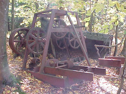
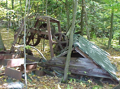
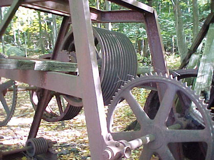
There was a bottom lift house that had a big, 6ft. in diameter, Iron wheel at the bottom of what was the ski hill. This building has been knocked down because of the threat of danger to hikers along the trail as it was less than 50 ft from the trail. He said that the last time he climbed the trail, at least 6 years ago, the top house, partially collapsed and with the big wheels for the rope was still there.
|
|
Apparently, there were plans to develop a resort on the mountain in the early 1970's. This could have been a ski area, or perhaps something else. |
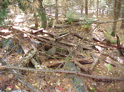
| Right - remnants of the rope tow. |
|
|
|
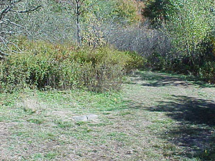
Continue up the trail past these ruins for about five minutes and you will come to the clearing mentioned in the previous set of directions. |
The actual lift remnants are about 100 to 200 feet down the hill from this clearing. As you begin down the hill keep and eye to the left. You will see the roof portion of the partially collapsed lift house through the trees about 200 feet into the woods. The following pictures were taken of the remaining parts of the lift.
The total length of the lift, based on where the bottom building was and where I found the top building is estimated to be about 500 yards. I was unable to locate any remnants of the second lift on this visit.
Does anyone have any further information on the Gap Mountain tow? If so email us!
Last updated: Dec 13, 2010