Lewisboro
Tow (Run by Lions or Kiwanis Club)
Lewisboro, NY
1969-Mid 1980's
History Memories Current Pictures
|
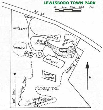
A map of the town park, showing the old ski tow at the bottom left. Map is from the Lewisboro town homepage, submitted by Fred. Visit it here. |
Fred
Jacobson has more information: It is in the existing town park,
the base of the old hill is still used today by may sledders, tubers,
boarders, every time there is snow. It actually gets quite
crowded. I am 39 and I grew up learning to ski
at the Lewisboro rope tow. I had to be 10-12 because I could
easily do the ropetow there which was quite primitive. There was
no clutch mechanism to make it easy to get on. First you picked the
rope up off the ground where it was burning through the snow track,
then, You had to let the rope burn through your leather mittens and then
slowly squeeze as you started moving. It was very unforgiving. There was no lift ticket, you had to
give the rope attendant at the bottom a dollar each time you wanted to
go up. If you fell off (very common) you were screwed and had to
hike up or down the rest of the way. It did not stop for you.
It was great fun and alot of kids around here learned to ski there.
The next big step up in skiing was another half hour north to "BIG
Birch", now "Thunder Ridge". I still use the trail for snowboarding during the winter. I actually learned to snowboard there about 7 years ago by hiking to the top and boarding down. It is a nice trail for the locals. I take my daughter there often when we are lucky enough to have a bit of snow.
|
Dave Argueso
has more information: The last year the tow
ran was about 1980, it shut down due high cost to run the tow which was being
paid by the Lewisboro Recreation department, no charge to use the tow.
The facts about it, the rope
tow was about a 1000 ft in length, both trails were beginner until it exited the
woods, where there is a steep face for expert that drop about 50 ft. at pitch of
25 degrees and ski across the infield and back to the tow. Or you could use the
crossover trail and return to the tow higher up. The tow itself was
modern for its time, it had metal lift towers all the way to the top. I think
just before I was old enough to remember, they may have upgraded the tow in the
late 70's, which might explain the towers. To this day, the towers still stand,
but the rope was removed by the town. It has a northern exposure, so when it did
snow it stayed there until it melted or was skied off. It is too bad they never
utilized the pond close by for a primitive snowmaking system, because it would
have been used more often. Instead they opted for improvements the baseball facilities
and installed irrigation systems it.
Sledding was very popular
there, people would hike half way up the steep face and use the whole baseball
field as their run-out. It was extremely fun, when the baseball field iced up
and you could sail all the way across the field at a good rate of speed, but you
to had hop off your sled or tube before you ending up in the swamp
bordering the perimeter of the outfield. In 1986, the town built a dugout
into the hillside and installed fencing preventing anymore sledding or skiing
down onto the field after improvement to field were done. There were rumors
during the mid-80's to reopen it, but the Rec. department realized the only
feasible way for it to work, was to charge a fee to use the tow and the it
was immediately dismissed and never considered again.
|
|
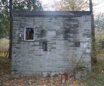
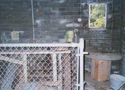
The old engine room for the rope tow, notice the plaque in the middle. Photo from John Fry. |
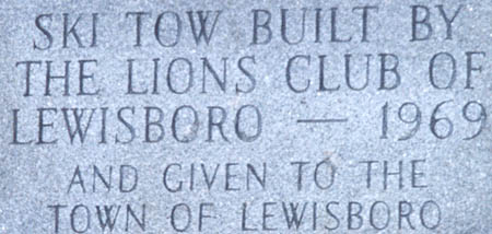
| Here's a view of a plaque still standing on the still standing engine room, thanks to John Fry. |
|
|
|
Looking inside the engine room, notice the rope tow machinery behind the fence. |
| David Argueso
took the following six pictures of the area during the winter of 2003.
Here they are and descriptions of each.
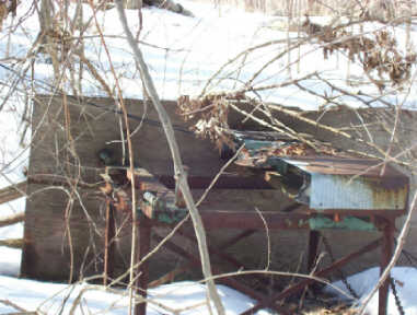
Base terminal photo: shows the technology at that time when the tow was used. The whole is overgrown with vines and bushes. |
|
|
|
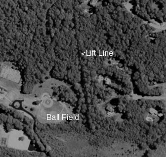
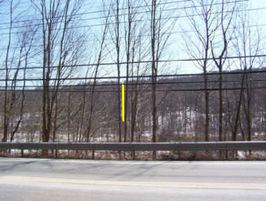
Liftline photo: still visible with snow, but hard see on the photo, I marked the line of the tow from base to summit. |
| Lift tower photo: is looking down the towline towards the base terminal, erosion caused by runoff from the new homes built about 50 yards has wiped out the lower portion of the line, this is one of two tower still standing. The tower mounted and bolted to concrete bases, which have broken down over time. The photo was taken about a 1/3 of the way up the towline, many people used to access the tow when the snow melted further down the line. |
|
|
|
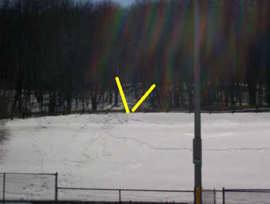
Runout slope photo: I marked where the trails exited onto the open slope to return to the base terminal. Today a parking lot was built on the runout just in front of the woods. As you can tell the pitch was fairly descent heading back to the tow, most had to traverse or ski onto the baseball field and then pole there way over to the tow. Just after the tow closed in the mid 80's, the fencing and the dugouts were constructed, wiping out any possible reopening of the tow. |
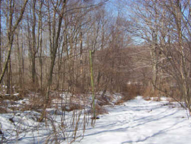
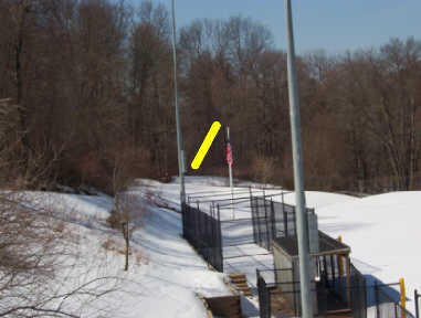
| Tow entrance photo: again another photo showing the pitch on the slope going back to the tow. The opening to base terminal is cleared about 15 feet into the woods, the rest is grown in. The yellow marking show the location of the tow entrance. |
|
|
|
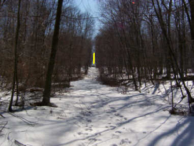
Towline photo: Taken at the same location as the lift tower photo, looking up the towline. The marking shows the top terminal. The upper section of the tow line is used a lot for hiking and snowshoeing. Not much erosion on this section of the line. |
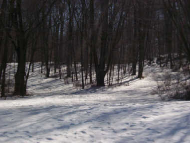
| Trails exit photo: show the trails exiting the woods on the open slope, I took the photo standing on a snowbank in the parking lot. Still used a lot for sledding, snowshoeing and hiking. |
|
If you have more information on this area just let us know.