Skidmore
College
Saratoga Springs, NY
1970-c1974
Thanks
to several NELSAP readers, we now know of this area that operated in Saratoga
Springs. Here are their details:
Cory
Clechenko: The other area I know about was
run by Skidmore College, and is now directly behind the campus, adjacent to
Scribner Village housing. There
were a few trails and a rope tow, with vertical
about 150 feet. The slopes have
grown in some, though are still obvious. Power lines
run up one old trail now. Also, some earth
moving/filling has altered the appearance.
I used to mountain
bike back there when I was in high school.
| Jimme
Quinn Ross: The Skidmore College Ski Slope was in operation from
about 1970 thru 1973/4. (Dates ?) Closed due to lack of snow. It was a
beginner slope about 1000' long. It was managed by my high
school sweetheart's dad. There was a T-bar and warming shed where you
could get a hot dog, soda, chips, and hot chocolate. I skied there only
a few times with my buddies, and naturally my girlfriend. It was a blast
having a 'ski area' so close to home. The slope was located just to the
north of the campus. There is a sizeable watertower nearby as a
landmark.
|
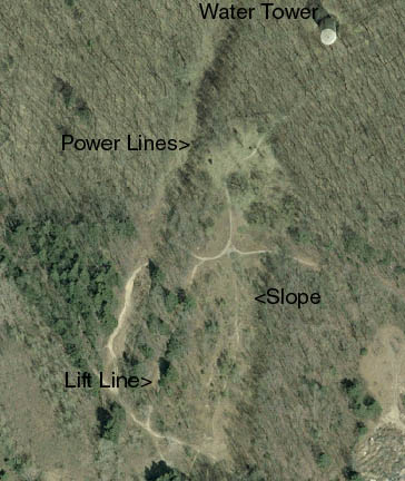
Here's an aerial, color shot of the lost
area. Note how the slope is growing in, but is still clear in stpots.
The liftline is relatively clear, as is the power line slope. The lift
line was approximately 800 feet long, with the slopes 800-1000 feet
long.
|
I visited this
area on April 20, 2003. It is really easy to check out and explore. Park at
Skidmore College (lots of lots there), and take a trail that is on the northern
end of campus. It has a sign in front of it explaining that it is the North
Woods, and that its open to the public. Do be careful not to litter, etc. Take
the trail that goes by a pond to the water tower. The area is just below the
water tower and is easy to spot.
|
|
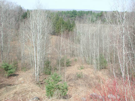
Just below
the water tower was the end of the T-bar. Here's the old counterweight. |
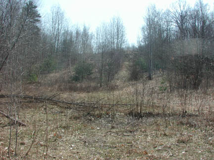
| The
main slope is really broken into two sections: an easy almost flat top
and a steeper finish. Here's a view halfway down. Notice the extensive
tree growth, but you can still make the slope out. |
|
|
|
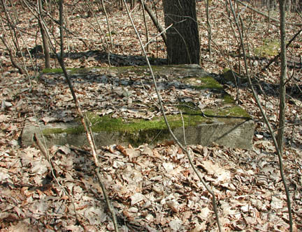
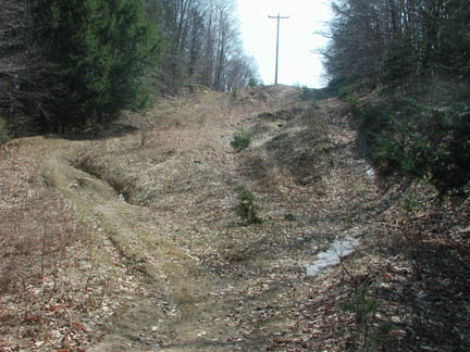
Just to the
right of the above picture, the T-bar liftline is clearly seen. In this
shot halfway down the liftline, you can see the cement blocks which used
to be the T-bar tower bases. There were about 3-5 sets of these bases.
This leads me to believe this was a croquet-wicket type of T-bar, likely
a Mueller, similar to Woody
Glen's. The lift line was cut into the hill and has eroded quite a
bit. |
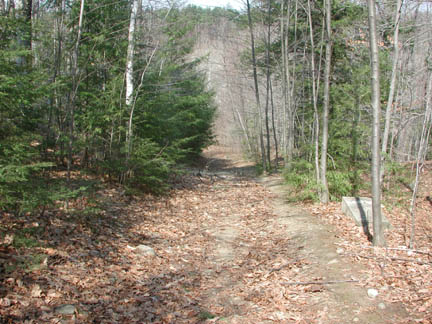
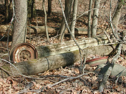
| However,
once I reached the bottom of the T-bar line, I found these two fallen
rope tow towers. Perhaps there was a second lift here, or maybe the
T-bar replaced an original rope tow. Hmmmm. |
|
|
|
According to
Cory's
above report, another slope was used and it now has a powerline on it.
Here's the bottom of that slope. Notice the one patch of snow/ice left
from the crazy winter of 2002-2003. |
| And finally,
a shot of the main slope, the bottom of the above picture. |
|
If you have more
information on this area just let us know.
Page last updated:
Nov 1, 2004
Head
back to Lost New York Ski Areas
Head
back to the Main Page